3D Laser Scanning Manhattan
Table of Contents
The Essentials of 3D Laser Scanning in Manhattan
In the bustling heart of Manhattan, where high-rises pierce the skyline and historic structures demand careful preservation, 3D laser scanning in Manhattan emerges as a vital tool for capturing precise as-built data. This technology addresses the unique challenges of urban projects, from scanning Midtown high-rises to documenting infrastructure like bridges and pipelines in dense environments.
3D laser scanning, also known as LiDAR surveying in Manhattan, is a non-invasive method that uses laser light to create detailed digital twins of physical spaces. In New York City, it excels in applications such as existing conditions assessments, clash detection, and construction progress monitoring for buildings, campuses, and commercial structures. For instance, precise building scans in NYC help reduce rework by up to 30 percent and enhance coordination among architects, engineers, and contractors, ensuring projects stay on tight timelines.
BuildScan3D stands out as a trusted provider of laser scanning services in New York, leveraging certified Leica, Faro, and NavVis scanners to deliver millimeter-accurate point clouds, 2D plans, 3D models, and BIM-ready files with precision up to ±1 mm. Their affordable, professional workflows, informed by NYC-specific standards, enable quick project starts and cost-effective solutions tailored to the fast-paced construction scene.
Explore further how this technology transforms local projects, from understanding its core mechanics to uncovering benefits, processes, and best practices for seamless implementation in Manhattan and beyond.
Understanding 3D Laser Scanning Technology
Core Principles and Equipment Used
At its core, 3D laser scanning technology relies on LiDAR principles, where laser pulses are emitted to measure distances and capture millions of points that form detailed 3D models of physical spaces. These high-precision LiDAR systems in Manhattan excel in environments requiring exact spatial data, such as construction sites amid skyscrapers. The process involves rotating mirrors or spinning heads that sweep lasers across surfaces, reflecting back to calculate point positions with millimeter accuracy, enabling comprehensive as-built documentation.
For Manhattan projects, providers like BuildScan3D utilize advanced equipment tailored to urban challenges. Stationary scanners, such as the Leica BLK360, offer portable, all-in-one solutions for fixed-position captures in tight interiors. Mobile options like the Navvis VLX allow walkthrough scans, ideal for navigating high-rises without disrupting workflows. Faro Focus models provide robust terrestrial scanning for exterior facades. These laser scanning services in New York integrate seamlessly with point cloud processing into BIM-ready Revit files.
- Leica BLK360: Compact for indoor scans, achieves ±4mm accuracy at 10m.
- Faro Focus: High-speed for large areas, supports up to 976,000 points per second.
- Navvis VLX: Wearable for dynamic mobile scanning, reduces setup time in dynamic sites.
This equipment ensures efficient data collection, supporting clash detection and asset inventories with ±1mm precision.
Cost Factors and Project Timelines
Pricing for 3D laser scanning in Manhattan varies based on project scale, complexity, and deliverables. Mid-sized scans, covering 10,000 to 50,000 square feet, typically range from $5,000 to $20,000, factoring in on-site data capture and post-processing into point clouds or 3D models. Additional costs arise for specialized outputs like Revit integration or virtual walkthroughs, often adding 20-30% to the base rate. Urban settings in New York demand premiums for access logistics, such as elevator use in high-rises or permits near landmarks, yet efficiencies from accurate surveys offset these by minimizing rework.
Timelines prioritize urgency for local services. Quick-start capabilities allow mobilization within 24-48 hours for pressing needs, like pre-renovation assessments in Brooklyn or Queens. Full projects, from scanning to processed BIM files, complete in 1-2 weeks, depending on data volume. For instance, scanning a Financial District office might involve a one-day site visit followed by registration and alignment in software, delivering CAD-compatible formats promptly. These structures address budgets by offering tiered packages: basic point clouds for $3,000-$8,000, or comprehensive scans-to-models up to $25,000 for larger facilities.
Budget-conscious firms benefit from phased approaches, starting with pilot scans to validate ROI before full commitment. References highlight how such services in New York enhance project efficiencies, reducing errors by up to 40% through precise existing conditions data.
Applications in Urban Environments
In New York City’s dense architecture, 3D laser scanning adapts exceptionally well to challenges like narrow alleys and towering structures. 3D scanning in NYC generates point clouds that map intricate details, from subway-adjacent buildings to historic renovations, supporting applications in architecture, engineering, and facility management. The technology captures as-built conditions for clash detection during new builds, ensuring HVAC and structural integrations avoid costly conflicts.
Point cloud generation begins with raw laser data, processed into versatile formats like E57 or PTS for compatibility with CAD and BIM software. For NYC building surveys, this enables virtual walkthroughs and BOMA calculations, vital for property assessments in Manhattan. Mobile scanners navigate crowded sites, while stationary units handle interiors, producing models with ±1mm accuracy for asset inventories and floor flatness analysis.
- On-site Capture: Deploy scanners to collect data in phases.
- Post-Processing: Align scans using registration software for a unified cloud.
- Deliverable Creation: Convert to Revit files or 2D plans for design use.
Examples include scanning Brooklyn bridges for maintenance or Queens campuses for expansions, where the tech’s precision streamlines coordination and supports sustainable retrofits. By understanding these applications, professionals can leverage the tool’s advantages, such as faster approvals and reduced field revisions in high-stakes urban projects.
Key Benefits for Manhattan Projects
In the fast-paced world of Manhattan construction and architecture, 3D laser scanning in Manhattan offers transformative advantages by capturing precise as-built data with ±1mm accuracy. BuildScan3D leverages advanced Leica and Faro scanners to streamline workflows for urban projects, from historic loft renovations to bridge assessments. This technology not only accelerates project timelines but also enhances coordination among architects, engineers, and contractors in New York’s dense environments. By reducing errors and enabling data-driven decisions, it delivers measurable ROI in high-stakes settings.
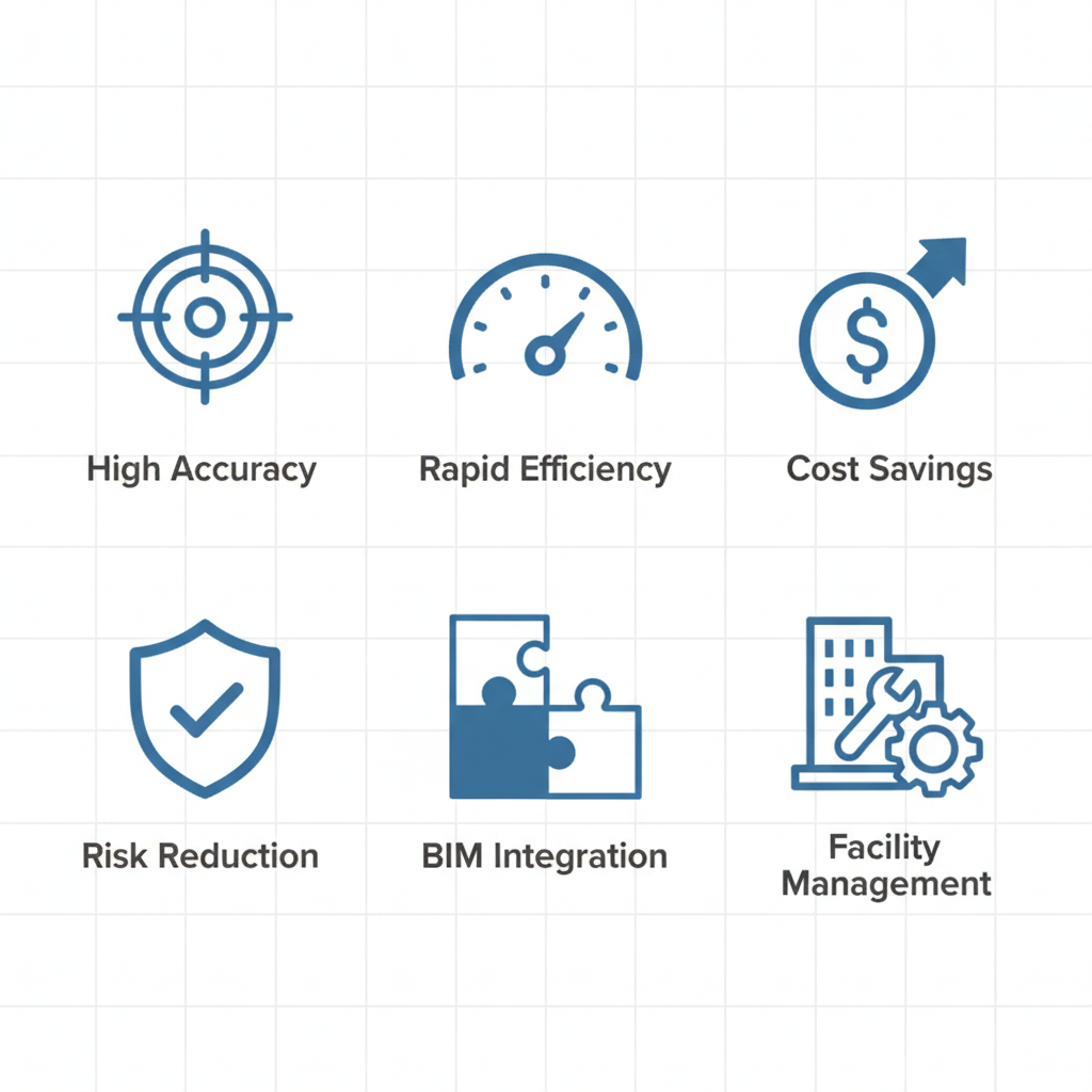
Icon grid highlighting 3D laser scanning benefits for projects
These benefits translate directly to improved outcomes for local professionals. For instance, precision scanning advantages in Manhattan minimize disruptions in crowded sites, allowing seamless integration with existing infrastructure like aqueducts or high-rises.
Enhanced Accuracy and Efficiency
3D laser scanning delivers unparalleled precision, achieving ±1mm accuracy that drastically reduces errors during design and construction phases. In urban builds, where space constraints demand exact measurements, this technology excels at clash detection, identifying conflicts before they escalate. Architects in NYC benefit from detailed point clouds that integrate seamlessly into BIM models, facilitating virtual walkthroughs and progress monitoring.
- Superior clash detection: Scans reveal interferences in tight Manhattan spaces, preventing costly on-site adjustments.
- Efficient documentation: Up to 20-50% faster than traditional surveys, as noted in industry analyses of 3D laser scanning surveys.
- Real-time progress tracking: Enables 3D scanning NYC teams to monitor advancements without halting operations.
For example, renovating a historic loft in SoHo, BuildScan3D’s scans ensured accurate replication of original features, cutting design iterations by half. This efficiency boosts NYC project efficiencies, allowing faster approvals and compliance with stringent building codes.
Cost Savings and Risk Reduction
Financial benefits of 3D laser scanning are substantial, with reductions in field measurements and rework leading to up to 30% time savings on projects. In high-stakes NYC environments, where delays translate to significant losses, this precision minimizes overruns. Traditional methods often require multiple site visits, but laser scans provide comprehensive data in one pass, slashing labor costs.
- Reduced rework: Early detection avoids expensive fixes, with case studies from Manhattan projects showing 25% lower change orders.
- Streamlined coordination: Shared 3D models foster collaboration, mitigating risks on complex sites like bridges.
- Budget optimization: ROI materializes quickly through fewer errors in material ordering and permitting.
A White Plains-based firm like BuildScan3D highlights how scans for an aqueduct inspection reduced safety risks and expedited timelines. In Manhattan’s volatile market, these savings and risk mitigations ensure projects stay on budget and schedule, enhancing overall viability.
Support for Facility Management
Ongoing advantages of laser scanning services New York extend to facility management, where accurate asset tracking and maintenance planning are crucial for Manhattan properties. Scans generate BIM-ready models for HVAC modeling and BOMA calculations, enabling proactive upkeep in aging high-rises.
- Asset inventory: Detailed 3D representations track components, simplifying inspections and renovations.
- Predictive maintenance: Identifies wear in systems like pipes, preventing breakdowns in dense urban settings.
- Compliance support: Facilitates energy audits and space utilization reports for property owners.
Property managers in New York report smoother operations post-scan, with one testimonial noting reduced downtime during HVAC retrofits. BuildScan3D’s deliverables, including Revit files, integrate into facility systems, supporting long-term sustainability and value retention in competitive real estate markets.
The Process of 3D Laser Scanning
The process of 3D laser scanning in Manhattan transforms complex urban sites into precise digital models, enabling architects, engineers, and contractors to plan renovations and expansions with confidence. BuildScan3D follows a structured step-by-step LiDAR process in Manhattan, adapting to the city’s dense environments and occupied buildings for minimal disruption. This NYC scan workflow ensures millimeter-level accuracy while addressing local logistics like tight schedules and safety protocols.
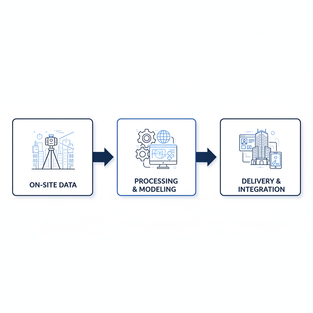
Three-stage process flow for professional 3D laser scanning services.
On-Site Data Collection
Initiate the project with a comprehensive field assessment of the Manhattan site, evaluating accessibility, safety hazards, and scanning requirements. BuildScan3D responds quickly, scheduling site visits within 1-2 days of client inquiry, as supported by efficient workflows in New York state scanning protocols that emphasize affordability and speed in urban settings.
- Scanner Setup: Position stationary Leica scanners for detailed interior captures in confined spaces, such as high-rise apartments or office lobbies. For expansive areas like commercial campuses, deploy Navvis mobile scanners to cover ground efficiently while navigating Manhattan’s crowded streets.
- Data Capture: Activate the equipment to record over 1 million points per second, creating a dense point cloud that documents every surface, fixture, and structural element. This 3D scanning NYC approach incorporates both mobile and stationary methods, ensuring comprehensive coverage even in occupied buildings without halting operations.
- Safety Measures: Prioritize urban adaptations, such as cordoning off areas and using protective gear, to maintain compliance in high-traffic zones.
Post-Processing and Modeling
Once raw data is collected, transfer it to BuildScan3D’s secure processing center for refinement, aligning with LiDAR scanning for building in NY standards that demand high precision for construction documentation.
- Alignment and Registration: Use specialized software like Leica Cyclone to register multiple scans, correcting for overlaps and distortions to achieve ±1mm accuracy. This step merges stationary and mobile datasets into a unified point cloud, essential for capturing intricate details in Manhattan’s varied architecture.
- Conversion to Models: Process the point cloud into actionable formats, including BIM files via scan-to-BIM services New York providers like BuildScan3D specialize in. Generate 3D Revit models for clash detection, HVAC modeling, and floor flatness analysis, identifying deviations down to the millimeter.
- Virtual Enhancements: Create immersive virtual tours from the aligned data, allowing clients to explore sites remotely before physical interventions.
Delivery and Integration
Finalize the project by packaging deliverables that seamlessly integrate into client workflows, supporting ongoing construction and facility management in dynamic urban settings.
- File Preparation: Compile point clouds, 2D plans, and 3D Revit models into client-specified formats, including CAD-compatible files for easy import into design software.
- Custom Outputs: Provide tailored reports on inspections, such as levelness analysis for floors or asset inventories, alongside virtual walkthroughs for stakeholder reviews. For Manhattan’s diverse sites, like historic renovations or modern high-rises, these outputs facilitate precise coordination.
- Workflow Integration: Deliver laser scanning services New York results via secure portals, enabling direct use in BIM environments for clash detection and progress monitoring. Point cloud modeling services NYC from BuildScan3D ensure compatibility with tools like Autodesk Revit, empowering teams to reduce rework and accelerate timelines.
Best Practices for Implementing 3D Laser Scanning
Implementing 3D laser scanning effectively in Manhattan requires careful planning to harness its precision for architecture, construction, and facility management projects. These best practices focus on selecting reliable providers, seamless workflow integration, and avoiding common hurdles in dense urban environments.
Selecting Providers and Areas Served
Choosing the right provider is crucial for successful 3D laser scanning in Manhattan. Prioritize companies with certified equipment from leading brands like Leica or Faro, ensuring millimeter-level accuracy essential for complex urban sites. Look for local experience in navigating New York City’s permitting processes and tight schedules, as these factors directly impact project timelines.
Key criteria include a proven track record in delivering point clouds compatible with Revit and CAD formats, along with strong data security protocols to protect sensitive project information. Reputable providers often offer consultations to assess site needs, providing sample work from similar Manhattan projects such as bridge renovations or high-rise assessments.
- Verify certifications and equipment standards.
- Review case studies from local projects.
- Confirm service areas including Manhattan, Bronx, and Staten Island.
Integrating with Project Workflows
Integrating 3D laser scanning into project workflows enhances efficiency, particularly in urban construction settings. Start with pre-scan planning to identify key areas for capture, using hybrid mobile and stationary methods to cover both interiors and exteriors without disrupting ongoing work.
- Conduct site assessments before scanning.
- Use scan-to-BIM for integration with design phases.
- Leverage point clouds for ongoing project monitoring.
Common Pitfalls and Solutions
Dense Manhattan sites often present challenges like data overload from surrounding structures, leading to processing delays. To counter this, employ filtering techniques during post-processing to isolate relevant point clouds, maintaining focus on the target area without overwhelming datasets.
- Filter data to manage volume in urban densities.
- Plan for environmental factors with flexible scheduling.
- Train staff on software integration for efficiency.
Maximizing Your Manhattan Projects with 3D Laser Scanning
In the fast-paced world of Manhattan construction, architecture, and facility management, 3D laser scanning in Manhattan stands out as a transformative tool for precision and efficiency. By recapping our exploration, we’ve seen how this technology captures intricate site details with ±1mm accuracy using Leica, Faro, and Navvis scanners, delivering BIM models, virtual tours, and as-built documentation that minimize rework and streamline workflows. BuildScan3D ensures rapid response and comprehensive coverage for NYC project optimization.
Contact BuildScan3D today for expert laser scanning services in New York. Reach us at +1 914 391 4631 or office@buildscan3d.com to schedule a consultation. Our team specializes in tailored solutions for architects, engineers, and contractors, providing 3D scanning NYC that integrates seamlessly into your design and management needs. Whether assessing existing conditions or monitoring progress, we commit to delivering actionable insights that drive success.
Looking ahead, the rise of digital twins promises to revolutionize NYC infrastructure, with state-wide adoption trends highlighting laser scanning’s role in sustainable, future-proof developments. Embrace this innovation to stay ahead in Manhattan’s evolving landscape.